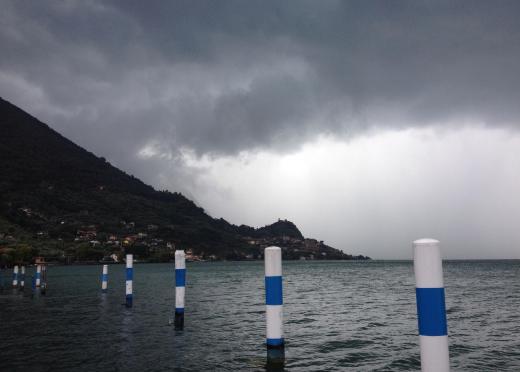
What are Nimbostratus Clouds?
Nimbostratus clouds are low-level clouds that are formed between the earth’s surface and an altitude of 6,500 feet (1,980 m). Like most clouds found in the earth’s atmosphere, nimbostratus clouds are comprised of small, condensed droplets of water or ice crystals. Clouds are commonly classified into a particular type by how they are formed, their location in the sky, their shape and color and the kind of weather that is associated with them.
Nimbostratus clouds are formed when the sun heats the surface of the earth. The air flowing near the surface of the earth absorbs this heat as it rises from the ground. The water that makes up part of the air rises along with the rest of the air.

As the air continues to rise, it both expands and eventually cools. When the air is cooled to a particular temperature, called the dewpoint, it condenses into droplets of water or ice crystals and forms a cloud. If condensation happens at a temperature above the freezing mark of 32°F (0°C) the cloud will be comprised of water droplets. If condensation occurs below the freezing mark the cloud will be comprised of ice crystals.
In terms of shape, a nimbostratus cloud is formless, flat and layered and it is often described as a blanket of cloud. This nebulous shape identifies a nimbostratus cloud as a stratus cloud, or layered cloud. Other types of stratus clouds are the altostratus and cirrostratus. These other types of cloud form at higher altitudes; however, all three share the characteristics of horizontal layering and a uniform base. Nimbostratus clouds are almost always found in the sky with a layer of pannus clouds beneath them, which resemble torn cloud shreds.
A nimbostratus cloud is dark gray in color. The cause of this color is the presence of moisture content in the cloud. The more moisture in the cloud, the darker the cloud will be. If a cloud is very dark, it is likely that rain or snow will occur in the near future. The Latin word nimbus actually means rain.
Nimbostratus clouds can produce either rain or snow. The kind of precipitation produced by this cloud may depend on the temperature found at the point in the atmosphere at which the cloud forms. It may also depend on the temperatures occurring between the surface of the earth and the cloud itself. The rain or snow produced by this type of cloud is typically light and can occur over a long period of time.
AS FEATURED ON:
AS FEATURED ON:


Discussion Comments
I can never understand the difference between the different types of clouds. To me, they all look the same.
It's a good thing I can check professionally obtained weather forecasts in a number of different ways. I wouldn't have done well in the days when people had to look outside to predict the weather. Cumulus clouds and nimbostratus clouds are all the same to me!
I would love to study some pictures of nimbostratus clouds to see if there is a difference in the way the clouds look depending on if they are made of water droplets or ice crystals.
It seems to me that the difference in air temperature, causing the water to freeze or not, could make the clouds have a different appearance? Is this true?
I guess I could just go outside and look at the clouds to see if there is a noticeable difference -- although it may be hard to remember what they look like from the time the weather changes from cold to warm -- but I am curious to know if there is a difference, even if it can't be seen from ground level. And I certainly don't have a camera that could get good enough pictures.
I thought that stratus clouds weren't usually the ones to bring rain, unless it was a light drizzle. I wasn't taking into account the different types of stratus clouds.
I love learning the Latin history behind a word, so knowing that nimbus is Latin for rain, will help me to better remember that dark, nimbostratus clouds bring weather that could make for a long rainy day.
Post your comments