How do Clouds Form?
Regardless of the type of cloud, the basic principles behind how they form are the same. Air containing water vapor rises, the water vapor condenses out of the air, and a visible body of water vapor, or cloud, forms. There are several types of clouds, but the basic classifications are stratus, cirrus, and cumulus.
The first step of a cloud’s formation is evaporation, transpiration, and the heating of air. Evaporation and transpiration, collectively called evapotranspiration, are vital parts of the hydrologic cycle. Evaporation occurs when a body of water, like a lake or ocean, is heated by the sun so that the water of the surface sublimates, or turns into a vapor. During transpiration, plants “sweat” water through their leaves and stems as part of a cooling process. This water then turns to vapor and mixes with air. Similarly, water from the soil may also turn into vapor when exposed to heat and air.

As a consequence of the ground and water surfaces becoming warm, the air near them is also heated. Because hot air is less dense than cool air, the heated air begins to rise into the atmosphere. As the vapor parcel rises, the atmospheric pressure drops and the parcel begins to expand. This expansion causes the vapor to cool, and the cooling causes the water to condense, or clump together, in the air. This is because cool air is not as able to hold as much water vapor as warm air is.

To summarize, the heat causes the air parcel to rise, the drop in pressure at increasing altitudes causes expansion of the air, the expansion of air causes cooling, and the cooling causes the condensation of water out of the air in the form of liquid droplets. The temperature at which condensation begins is called the dewpoint. The dewpoint occurs when the air is saturated, or holding as much water vapor as it can, given its temperature and pressure. More water continues to condense as the air rises, until the air parcel reaches the same temperature as the surrounding atmosphere, or its equilibrium temperature. If the water vapor condenses into enough liquid water to become visible, it is called a cloud.

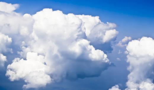
The shapes and types of clouds largely depend on how long the parcel of vapor rises after it reaches dewpoint, or in other words, the distance it rises between dewpoint temperature and equilibrium temperature. An air parcel that continues to rise for a long time after reaching dewpoint will create a tall, fluffy mass, such as a cumulus cloud. This type is puffy and has defined edges. An air parcel that reaches equilibrium at nearly the same time it reaches dewpoint will create a flatter, layered mass, usually a stratus cloud. They form low to the ground and look like a gray blanket.

On a particularly hot day, it may take the air parcel a very long time to cool down, causing a high formation of clouds. Cirrus clouds, otherwise known as “mare’s tails,” are wispy or feathery masses that sit so high in the atmosphere that their droplets crystallize. There may be combinations of cloud classifications, such as cirrostratus or cirrocumulus. A nimbus is a cloud which produces precipitation.
AS FEATURED ON:
AS FEATURED ON:


Discussion Comments
How do clouds form with heat energy, warm air rising, dew point, air cooling down, condensation, molecules speeding up, and molecules slowing down?
I have always heard that clouds form at the point where cold and warm air masses collide. This is where you see a lot of bad storms, like tornadoes and hail storms.
@wavy58 – I have been terrified of storms all my life. I've learned to watch out for certain weather conditions and cloud formations that indicate an approaching storm.
Seemingly harmless altocumulus clouds usually mean a storm is on the way. They form in the morning sometimes on a humid day, and by that afternoon, a thunderstorm has usually arrived.
These little clouds are puffy and cover the sky in rows. Sometimes, they look like rows of fish scales, and I once saw line after line of heart-shaped altocumulus clouds. They always seem to form in patterns.
I have always associated cirrus clouds with good weather. When they are the only kind of clouds in the sky, it is mostly clear and blue.
I can remember seeing them on several hot days at the lake. I liked to float on my back and watch the little cirrus clouds do their spiral curls in the breeze.
As long as these were the only clouds in the sky, we knew that we wouldn't have any problems with lightning. Cirrus cloud days were so pleasant and relaxing.
I live in the southeastern United States, and it is very humid and hot during the summer. We see a lot of cumulonimbus clouds, and sometimes, they form so quickly that you can actually watch them grow.
There is so much hot moisture in the air that it just rises and rises, and I've even sat and watched really tall, fluffy clouds expand upward. I can see the lightning inside these clouds, and it is often constant.
We get some severe thunderstorms from cumulonimbus clouds that form in summer. We have more bad weather in the summer than in the winter.
When I was a child, I wasn't one of those kids who thought clouds were marshmallows or candy fluff or anything like that, the way people sometimes say kids think. I guess I didn't think about them at all, and I think it was awhile before I really associated clouds with rain.
this was so interesting and it was good for the education of students.
Post your comments