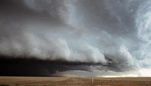
What is a Cold Front?
 Mary McMahon
A cold front is a boundary at the edge of a cool air mass. Meteorological activity often takes place at this boundary as a result of interactions between the cold front and warmer masses of air. On a weather map, this phenomenon is represented with a blue line illustrating the boundary, and a series of triangles indicating the direction of movement. Movement of fronts is often very predictable because they tend to follow established weather patterns.
Several characteristics can be seen inside a cold air mass. The air is denser, and thus the mass tends to cling close to the ground. This forces warm air upwards. At the cold front, the air pressure is higher and will remain high as the cool mass moves over the ground, and the temperatures are cooler. It is important to be aware that these air masses are not necessarily cold in the sense that people will want to pull out a jacket while they pass; they are simply cooler than the other air masses in the region. They can also be dry, without any rain at all, if humidity levels are low.

The cold front acts as the leading edge of a wedge. Where it interacts with warmer air, it is common to see gusts of wind and precipitation caused by water vapor in the air responding to the change in temperature. Sometimes, very severe storm systems can form, with hurricanes and tornadoes appearing. This is most common when multiple fronts collide and start to mix.

As a cold front travels, it will start to warm up. The sun will heat the Earth's surface and this acts to radiate heat through the air, forcing it to warm up and start rising. This will lead to changes in weather patterns. People in the northern hemisphere may notice that poor weather tends to move in from the north, the result of cold fronts moving towards areas of warmer air to displace them as more cold air is generated in the far north. In the southern hemisphere, the reverse is the case.

Meteorologists can identify a cold front with temperature sampling. If they notice a dramatic temperature differential between two locations, there is clearly a boundary between two air masses between them. It is possible to track the front while making predictions about how it will move so that the public can plan its activities accordingly. People may need to do things like covering plants to protect them from frost, or closing the shutters on the windows in advance of a storm with high winds.
AS FEATURED ON:
AS FEATURED ON:


Discussion Comments
Very helpful!
Post your comments